All  Aerial Services offered, Purchase, and/ or Short Term Rental Arrangements can be made

-------------

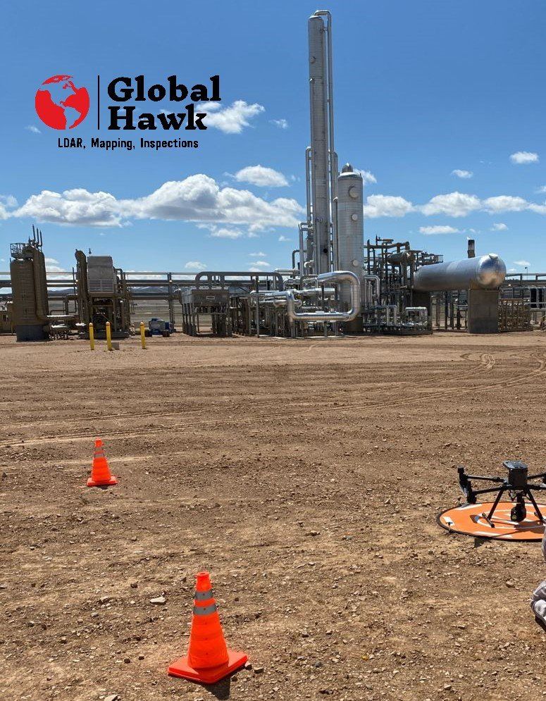
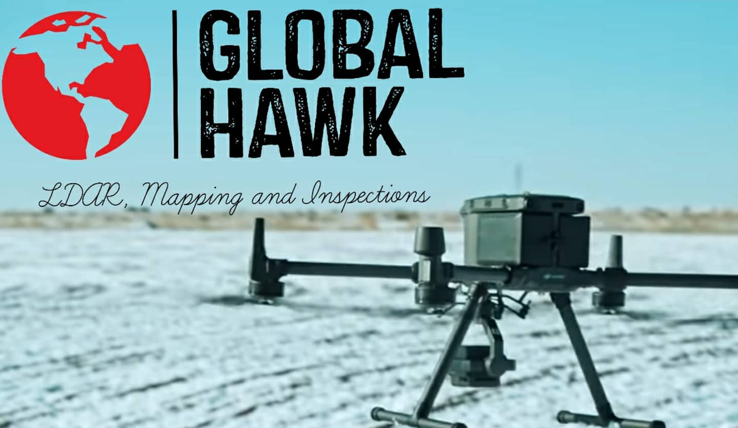
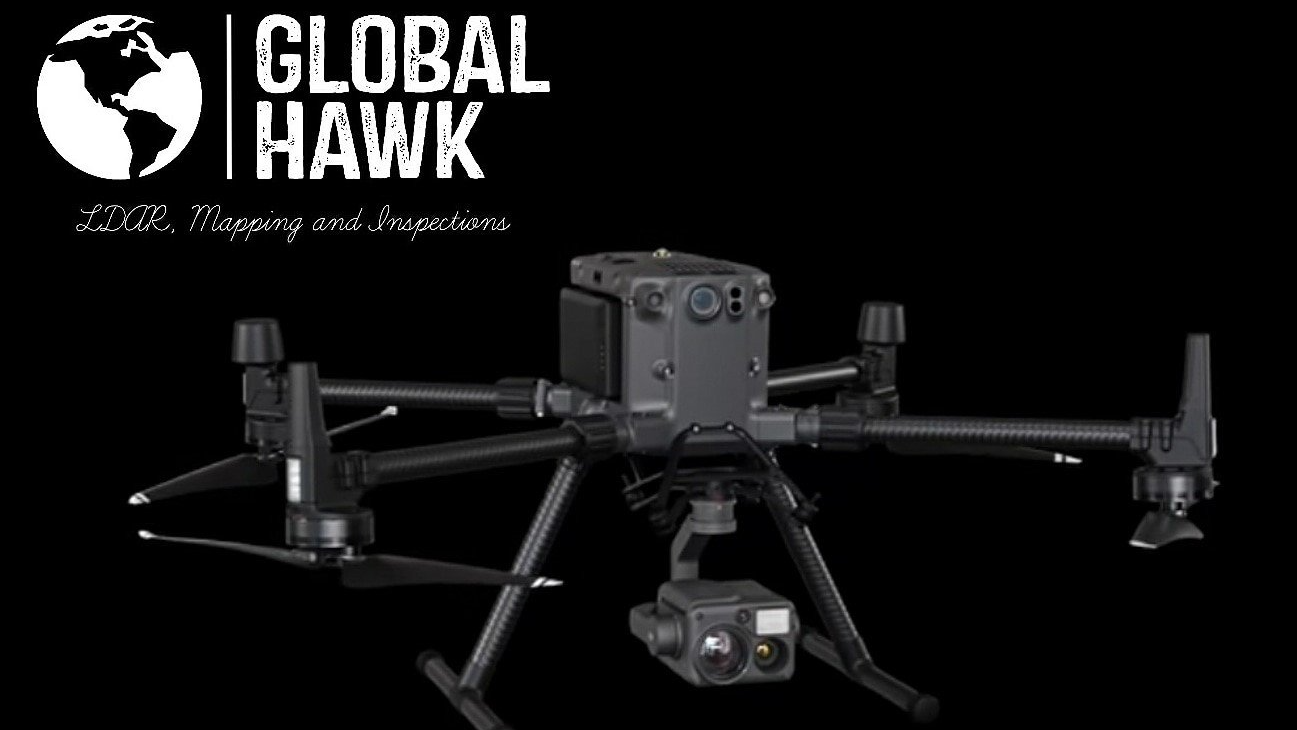
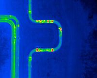
Our Ventus 640 OGI-Camera with X-Port Gimbal, Payload Model : "Ventus 640 UAS ", for DJI Matrice 300 RTK Enterprise Drone Platform Has 23 Visible Carbon Based Gases As Listed

-------------
DETECTABLE CARBON GASES:

Acetic Acid, Ammonia, Benzene, Butadiene, Butane, Ethane, Ethylbenzene , Ethylene, Heptane, Hexane, Isoprene, Methyl Ethyl Ketone (MEK),

 Methane, Methanol, MIBK, Octane, 1-Pentane, Propane, Propylene, Sulphur Dioxide, Toluene, Vinyl Chloride and Xylene


IS-NETWORLD & PEC-Veriforce


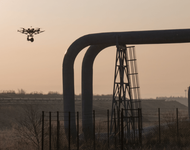
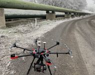
UAS & UAV Aircraft Flying Routes with Capabilities such as:

(OGI Stands for: Optical Gas Imaging)

*FULL-SERVICE SURVEY & LIDAR SCANS

* Drone OGI-Camera (Gas Leak) Asset Inspections

* UAS LiDAR Point-Cloud Scans & Mapping

* LiDAR Easement Mapping & Encroachment Mapping

* Emergency Response With OGI-Camera & Thermal

* Accident Reconstruction Mapping & Measurements

* Search and Rescue with high grade thermal scans

* A.I. Spot Check of Site Inspections

* 2D-3D Construction Site & Asset Mapping 

* Geo Tagged Images & Marked Issue Locations

* Electrical & Utility ARC Flash Studies

* Aerial UAS LDAR Inspections (CDPHE & AIMM Cert.)

* Aerial UAS Photogrammetry and Modeling

* Thermal Integrity Inspections

* Thermal Mapping with LWIR Camera 640x512

* Reclamation, Agriculture, & Land Health Mapping

* External Tank Level Checks (via Thermal Imaging)

NOW OFFERING DIGITAL TWIN MODELING WITH BIM AND AS-BUILT

SAVINGS - SAFETY


CAD File Imaging IMPORT & EXPORT capabilities

Export & Contour Files (DXF/SHP) and GeoTIFF Files from Equipment to almost any Software.

Ability to Export Contours with a GeoTIFF File and Import into AutoCAD, AutoDesk, and More. 

Abilities to Export Elevation Maps as a GeoTIFF & Import into QGIS to render the correct digital surface models.

Exporting Contour Files (DXF/SHP) & GeoTIFF Files from our software & Import into QGIS.


Reduced Costs, Safety Hazards, & Reduced Liabilities Using UAV's For all Site, Facility, Utilities, Telecom Towers, Water Towers , Easement, Vessel, Tank, and Pipeline Inspections

 with reduced Costs and a Faster turn around time for OGI Inspections. Our clients fully benefit from the decades of O&G & Energy experience we have in our Industry. 

Live/ Lit Flare Stacks & Flare Stack Integrity Inspections using UAS Thermal Systems Done with Drones
 So many times we hear of Oil and Gas companies spending thousands and thousands of dollars on Fire-proof gear for inspecting a Flare stacks that have been off for hours but OSHA doesn't want that risk and neither do the contractors want the risk of a severe burn or injury. There's full harnesses and Lift gates, and much more including cranes involved to just inspect a Flare stack annually. 

All this can be done with the simple use of a highly equipped UAS and a very Informed and well trained operator. These inspections can cost 1/10th of the cost for the same inspection and most of the time you'll get better and more data. Call Global Hawk, LLC today for an estimate on your flare inspection, Data report, and Thermal Video.
Global Hawk, LLC puts a lot of thought and pre-planning into our safety and our customers safety. We can show the engineers what we are seeing in a live video feed for them to tell us to inspect what they feel is the most important to them. These inspections can be done using high grade thermal and done annually. Signing a annual contract with Global Hawk, LLC can save your company up to 20% more than the tens of thousands they're saving just by using our services on and in safety costs. Customer service and cost is second to only safety for Global Hawk, LLC.

What Global Hawk, LLC  thinks of when we think of LDAR, Imaging, A.I.  Spot Check's, and Mapping with Drones. 

"WE THINK OF SAFETY"

 At Global Hawk, LLC we bring you the very best technology on the market with A.I. software and Thermal imaging Cameras. With our mobile control center and extremely powerful DJI Drones we can fly in some of the toughest weather or situations. With the best in DJI Enterprises Drones, ability for Gas Leak Inspections, thermal imaging, and A.I. leak spot checking and leak detection software available, we can provide whatever job you need with our amazing and AI smart software and equipment. Our Ventus OGI-Camera and custom built turn key UAS Gas Leak Imaging abilities are the best in the world and quickly becoming an Oil and Gas Aerial LDAR "gold standard". We tailor each customers experience with our custom Drone equipment and A.I. software in conjunction with LDAR and leak detection software to allow for further monitoring of leak prevention and detection at all times while in between Drone mapping passes.(required quarterly by CO EPA) Our very talented UAV pilots and heavy umbrella insurance policy will give you peace of mind proving that you have nothing to lose and everything to gain by using Global Hawk mapping services. Raise your safety record as well as help in prevention of future hazards, work place incidents, and expensive government agency fines by preventing leaks and integrity issues before they happen. Give us a chance to solve any costly issues you are looking to avoid in the future and call for your free quote and a rundown of what you could save financially with our service.
-Seth Berry, President
liDAR Mapping
Click Image to Learn More

ARC Flash Studies

LDAR Mapping Equipment 

Mapping and Imaging
Click Image to Learn More

UAS Imaging and 

UAS 2D-3D Mapping 

3D Mapping
Click Image to Learn More

Leak Detection 

Thermal Software 

 Gas Mapping, LDAR Mapping, Agriculture scans & health Maps,  Electrical, & ARC Flash Studies

Drone imaging with certified UAV pilots for Gas Mapping and Leak Detection. Photometry and liDAR image mapping with the best technology and commercial equipment that allows us to offer ARC Flash Studies as well.
Contact Us
Share by: